| |
Coastal Paddling Trails
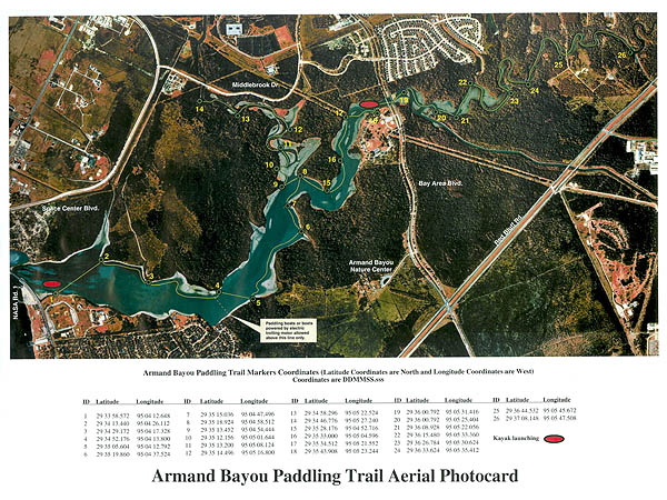
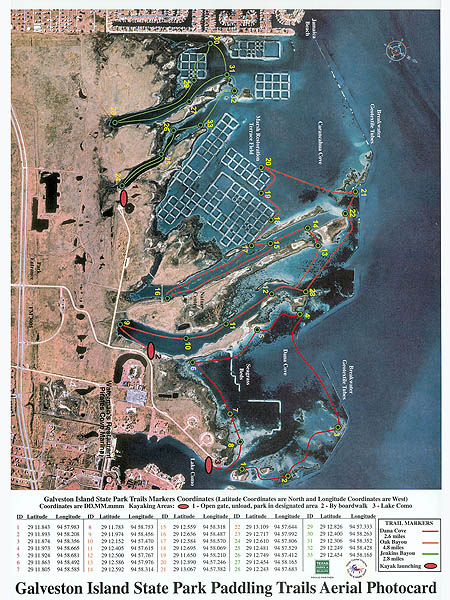
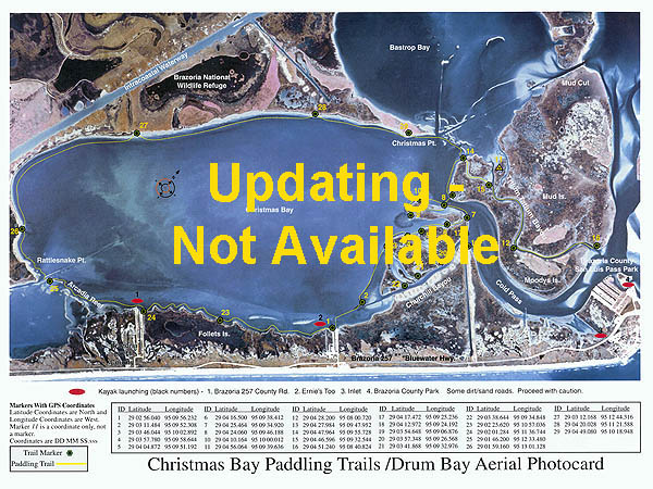
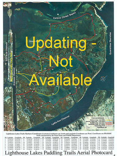
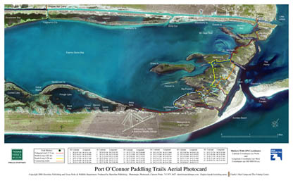
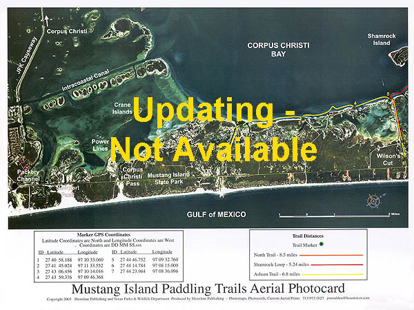
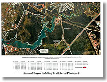
The following photocards show marked paddling trails. The trails were made by the Texas Parks and Wildlife Department. Each trail is marked with PVC pipes attached to numbered signs. The GPS coordinates of each marker is on the photocard.
Additional features:
• Paddle and boat launches are shown on the photocards.
• Names of bays, bayous, channels, cuts, points, flats, etc. are on each photocard.
• Photocards may have descriptions or links to trailinformation.
Size – 9" x 12" laminated
Cost - $9.95 to $11.95 each |
|
| |
|
|
|
|
Armand Bayou Paddling Trails
View Back of Photocard |
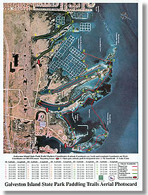
Galveston Island State Park
Paddling Trails
View Back of Photocard |
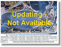
Christmas Bay Paddling Trails
View Back of Photocard |
| Put-In and Take-Outs, markers with GPS coordinates
Trail markers with GPS coordinates
Paddling and bayou information with points of interest
More Info - Texas Parks & Wildlife |
|
Put-In and Take-Outs, markers with GPS coordinates
Paddling and park information with points of interest
Kayak launching
More Info - Texas Parks & Wildlife |
Put-In and Take-Outs, markers with GPS coordinates
Kayak launching
More Info - Texas Parks & Wildlife |
|
|
|
|
• Put-In and Take-Outs, markers with GPS coordinates
• Kayak launching
More
Info - Texas Parks & Wildlife |
• Put-In and Take-Outs, markers with GPS coordinates
• Kayak launching
More
Info - Texas Parks & Wildlife |
• Put-In and Take-Outs, markers with GPS coordinates
• Kayak
launching
More
Info - Texas Parks & Wildlife |
|
| |
|
|
| |
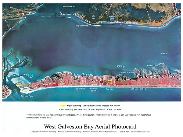
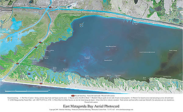
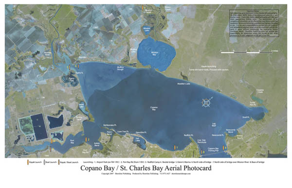
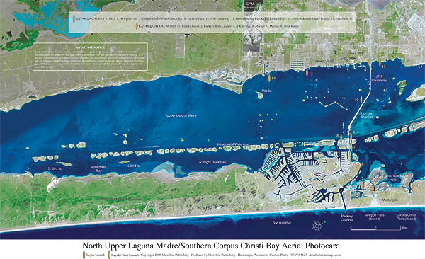
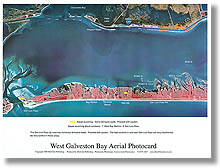
Photocards show boat and kayak launching spots, names of bays, points,
bayous, lakes, etc.
Coastal Photocards - small format
Size – 9" x 12" laminated
Cost - $9.95 each |
Coastal Photocards – large format
Size – 17” x 10.5" laminated
Cost - $11.95 each |
|
|
| |
|
|
|
West Galveston Bay
|
|
|
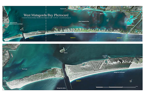
• Kayak/boat launching |
• Kayak/boat launching
Size - 17" x 10.5"
Cost - $11.95
|
• Kayak/boat launching |
|
|
|
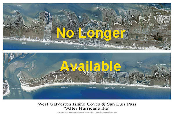
West Galveston Island Coves & San Luis Pass
"After Hurricane Ike"
|
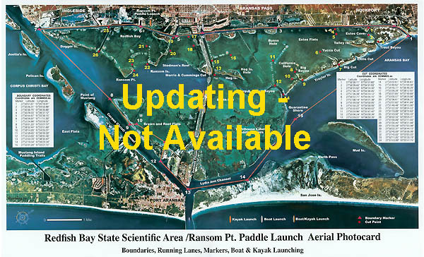
• GPS coordinates of the beginning and end of channels
in Redfish Bay
• Put-In and Take-Outs
• Markers with GPS coordinates
• Kayak/boat launching Ransom Pt.
• Paddle Launch
• Shows boundaries of the State Scientific Area
• Fishing and other information about Redfish Bay |
•
Kayak/boat launching |
Size – 9” x 7.5”
(Printed on photo paper)
Cost - $12.95 |
|
|
|
|
Size - 17" x 10.5"
Cost - $11.95 |
Size - 17" x 10.5"
Cost - $11.95 |
|
|
|
|
| |
Size – 17” x 10.5”
Cost - $11.95 |
|
| |
|
|
|
|
|
|
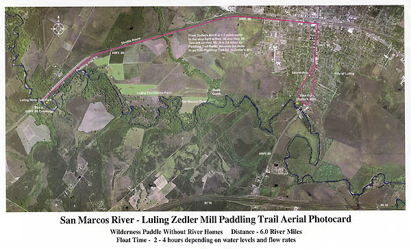
• Put-Ins and Take-Outs with GPS coordinates
• Kayak/boat launching
• Paddling and river information
More
Info - Texas Parks & Wildlife |
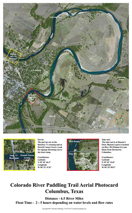
• Put-Ins and Take-Outs with GPS coordinates
• Kayak/boat launching
• Paddling and river information
More
Info - Texas Parks & Wildlife |
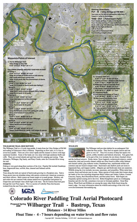
• Put-Ins and Take-Outs with GPS coordinates
• Kayak/boat launching
• Paddling and river information
More
Info - Texas Parks & Wildlife |
|